Expedition to the Glacier d’Otemma
4 days at the foot of a Swiss glacier: walking, weather surveys, drone and photography
Discovery of the cryosphere and the high mountain world before a 3-week expedition in the Karakoram massif in Pakistan in August.
Arrival at Mauvoisin
It is 11:30 pm when I am boarding on a bus to Geneva, which takes me to my destination after 7 hours of travel, shortly after sunrise. I finally leave my seat to get in another one, in a train leaving Geneva to join Alexander Groos, a glaciologist at the University of Nuremberg and Ann Christin Kogel, undergraduate student at the University of Bonn. I am going with them to the southwest of Switzerland for a survey on a glacier. We arrive in a village in the Bagnes valley where Thomas Shaw picks us up by car to the starting point of our walk. Thomas, full of energy and with a sparkling look in his eyes, gets out of the vehicle on which we can read WSL Federal Institute for Forest, Snow and Landscape Research. He is a British researcher who has lived in Switzerland for a few years, and specializes in glaciology and high mountain hydrology. The project that brings us here and that Thomas is part of is called TEMPEST (Global Air TEMPerature ESTimation on High Mountain Glaciers).
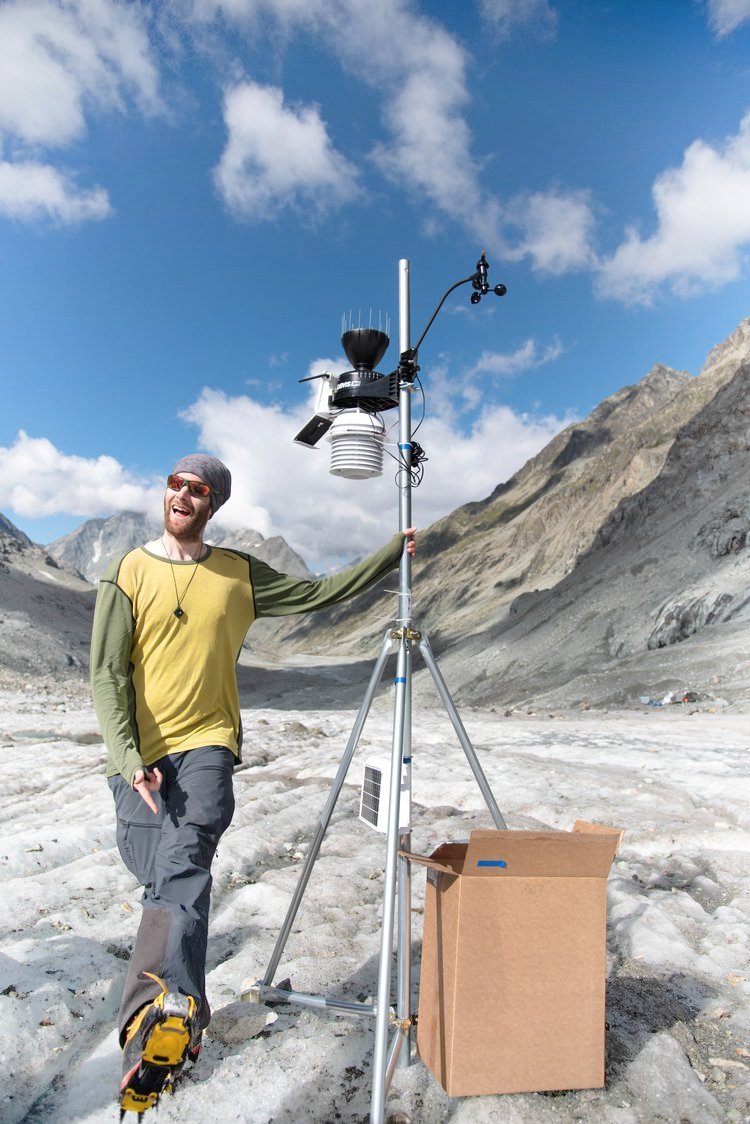
While glacier melting processes are well known, the complex meteorological conditions taking place on the surface of glaciers, which evolve rapidly over a few hours, are not known on a fine scale, either spatially or temporally. Thus, Thomas wants to study 3 glaciers of the region by equipping them with weather stations and ablation stakes (meters that witness the melting of a glacier). The one we are going to study is the glacier of Otemma, very close to the border with Italy. It reaches 3800 meters of altitude at its highest point and covers 16km² with a length of 8 km, which makes it a rather large glacier for the region. My new travelling companion, Alexander, is in charge of bringing two large but relatively light monoplane drones, equipped with a small propeller engine and thermal, humidity and wind speed sensors, which will bring additional and useful data to the understanding of the atmosphere above the glacier and how it can change during the day.
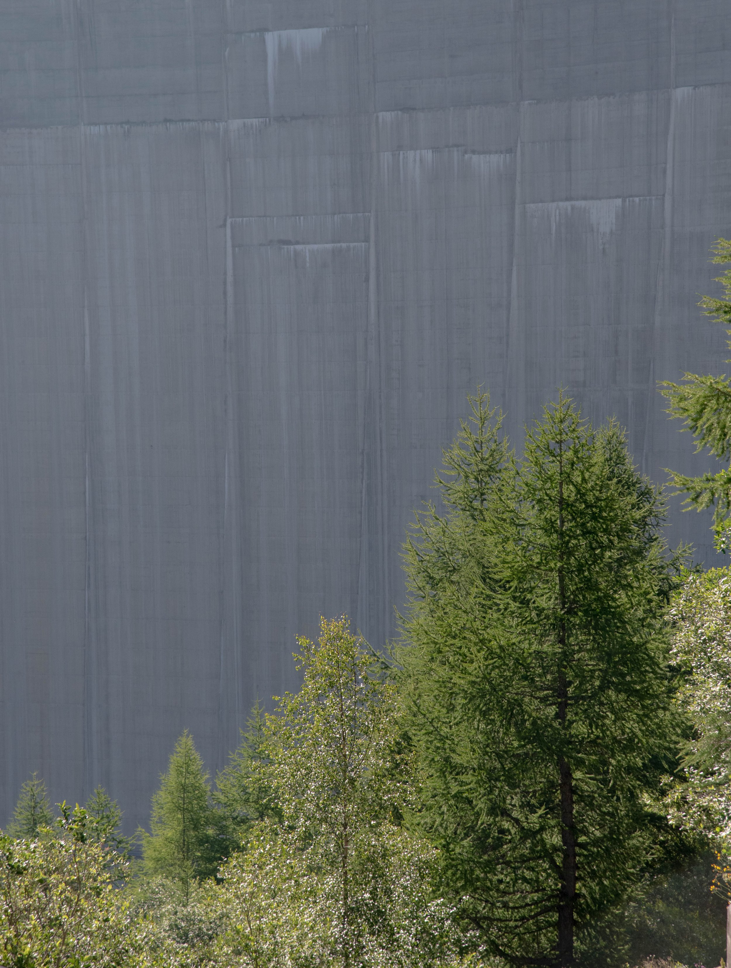
In addition to Thomas, we meet other specialists of the glacial environments that I join at the rendezvous point, a quiet hotel crushed by the colossal dimensions of the Mauvoisin dam a little further back, backdrop of our departure. I meet Michael McCarthy, researcher at the WSL and Marta Corrà, a Masters student in Bern, both living in Switzerland and as passionate about mountains and glaciers as their colleagues. We have a bite together, get to know each other and start the last preparations where we check our bags and try to divide the equipment, tools and food among us according to the weight. I end up with a bag of about 20 kilos, a considerable weight for someone who rarely goes camping in the mountains, but I am happy to help as much as I can. In spite of that, my motivation and my thirst for adventure make me optimistic. The team sets off, the road begins and my body immediately goes on alert: the weight of the bag conjugated to the heat of July at these 1700 meters of altitude in addition to the important difference in level to arrive until the foot of the dam make the three hundred meters very trying, the time that I adjust the bag, and get used to the rhythm. In spite of that, the road offers impressive views, starting with the pine trees perched on rocky peaks with a concrete-colored and textured canvas in the background, that of the dam which stands straight ahead and to which we access through a network of wet and cool tunnels , a freshness that is the most welcomed.
The slope is steep, our silhouettes bent, our bags big and heavy, and the dim lights along the dark conduit remind me of a procession of miners. At the exit, we arrive at the level of the reservoir, a turquoise-coloured, opaque-textured water whose surface is perfectly smooth, undisturbed by the ten or so vehemently powerful waterfalls that flow into it. During the four kilometers that the lake makes in length, I have all the leisure to discuss with the members of the expedition, when I am not trying to catch my breath, and to admire the mountainous faces high up, with their bare and sterile rocks which always have on me a bewitching power when I observe them from a verdant and flowery landscape. At the end of the lake, where the valley narrows significantly, things start to get serious as most of the ascent begins on a relatively short distance and a very steep slope. It's 5 long kilometres where each step makes me feel like leaving my bag on the ground and stopping but the rhythm of my teammates pushes me to put one step in front of the other, even if my shoulders, my neck, my lower back and my legs are struggling with every meter. As I am writing this, I have a confused memory of that moment, I have trouble remembering precisely my thoughts and reflections: I believe that all my energy was going to my muscles and that my brain, failing to record memories, was controlling my motor skills and my heart rate.
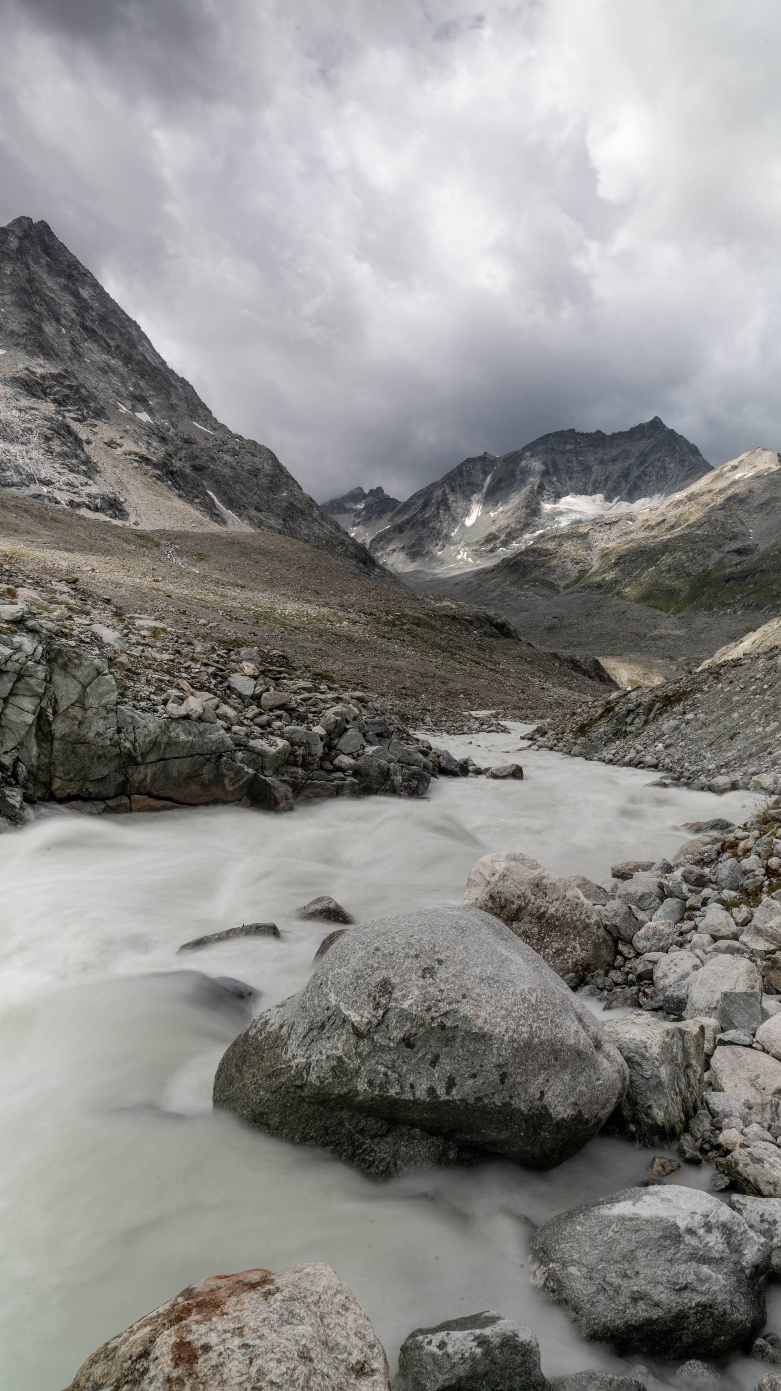
After this intense ascent, we notice the landscape change: we enter the nival stage -after the alpine stage-, with its bare rocks, its lichens and some rare short plants sheltered in the cavity of rocks whose merciless shapes, blocks of stone with badly battered faces are tormented, scratched by the wind, the cold and the snow in winter. Some rocks are even split in two, in three, by a sharp, clean break, the work of water that seeps in, freezes once winter comes and finally makes the stones burst. One of the many forms of erosion in the mountains, without doubt my favorite. A few hundred more meters of progress in this gray canyon where a beige water flows with speed and crash below. A few hundred more meters and my teammates announce me with joy that they see the tents in the distance. Relieved by the news, I slow down my pace and take some pictures of this place so new for me before the emerging darkness of the sky swallows up this landscape for today. My last steps have a savour of salvation and I immediately make one of the small tents of the base camp my home by throwing my bag, unrolling my mattress and sleeping bag, after having removed my shoes so as not to dirty what will be my home for the next four days. A violent thunderstorm breaks out, for my greatest pleasure, the rain falls without restraint. The weather will remain very unstable for another day.
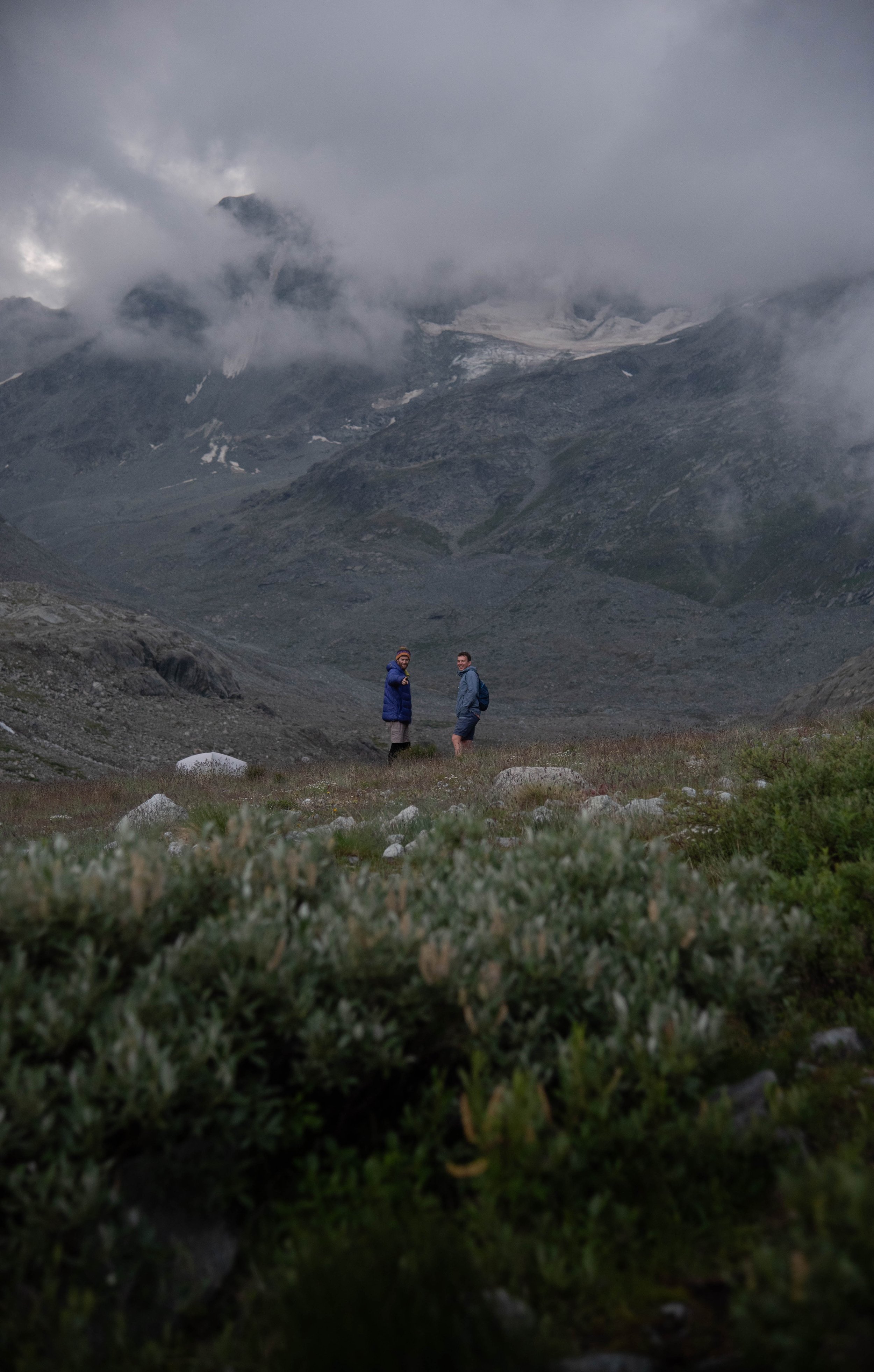
Thomas and Alexander spotting me from afar

Thomas and Mike, about to leave

The glacial stream
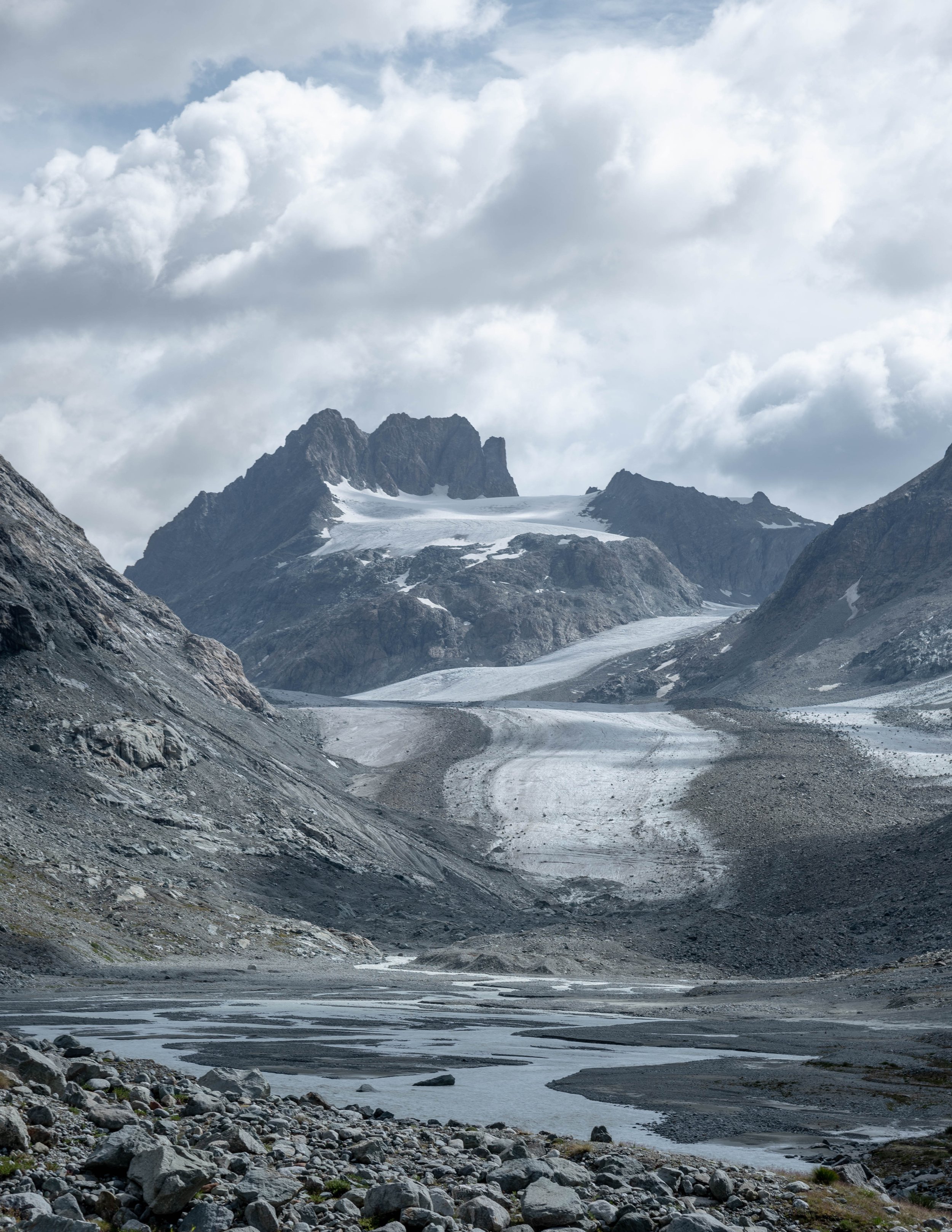
the glacier and meanders of metling waters forming at its bottom
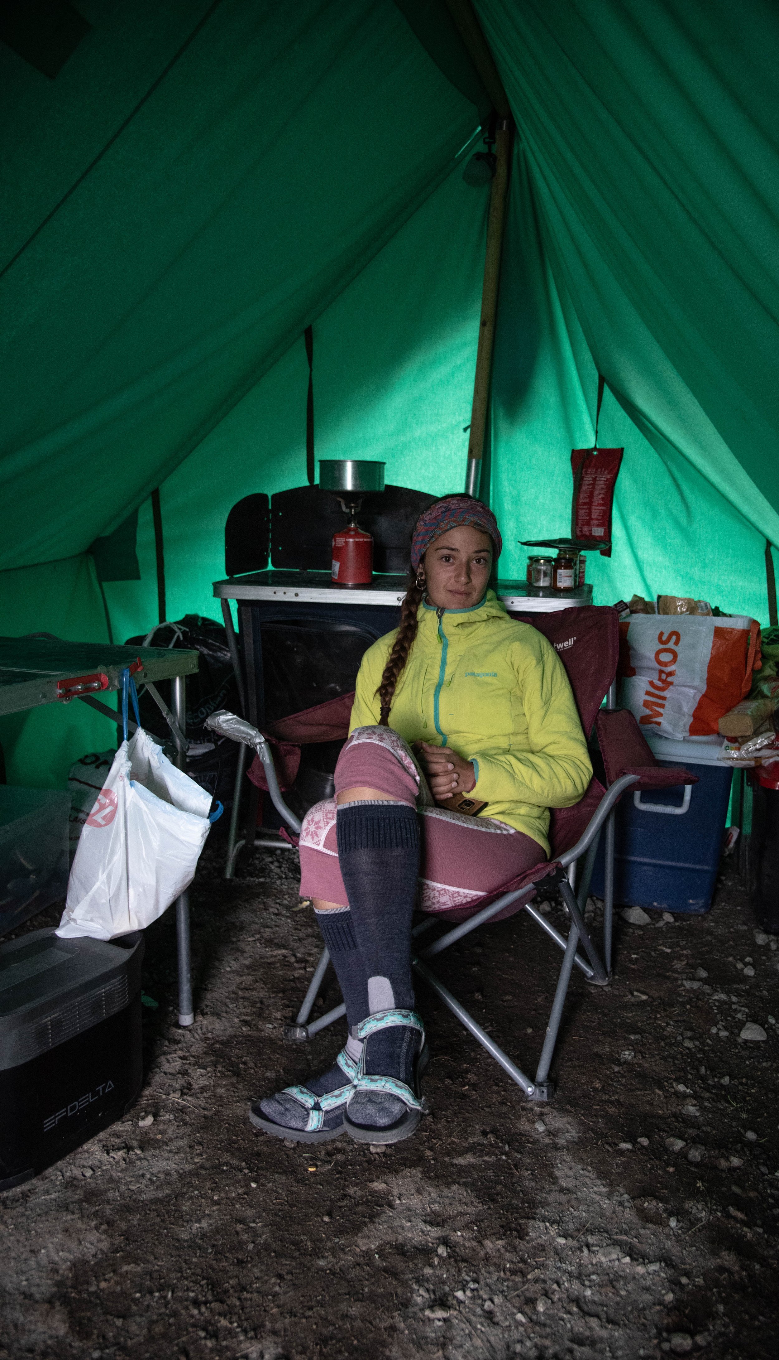
Marta in the main tent
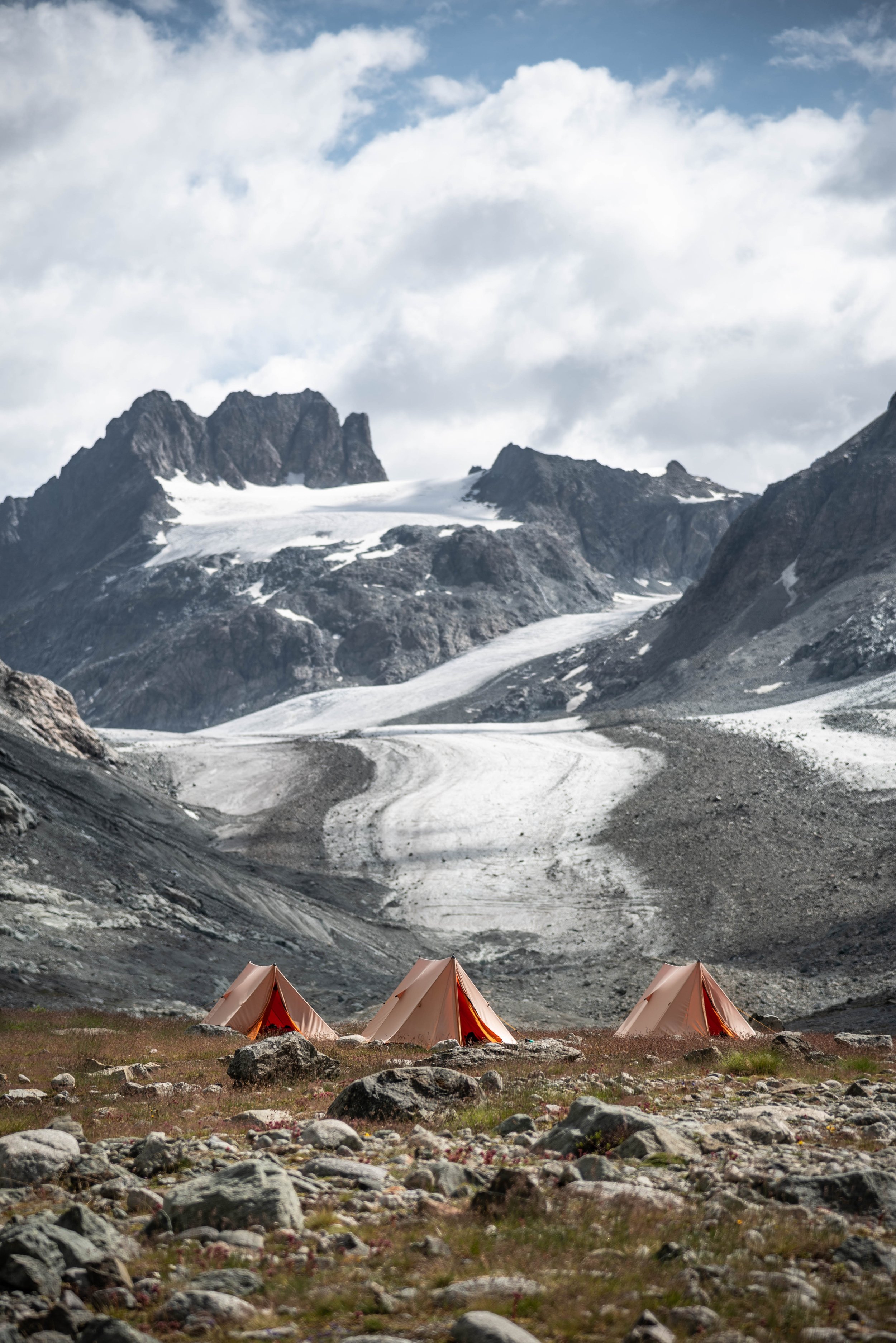
The base camp

Alexander holding one of the weather station
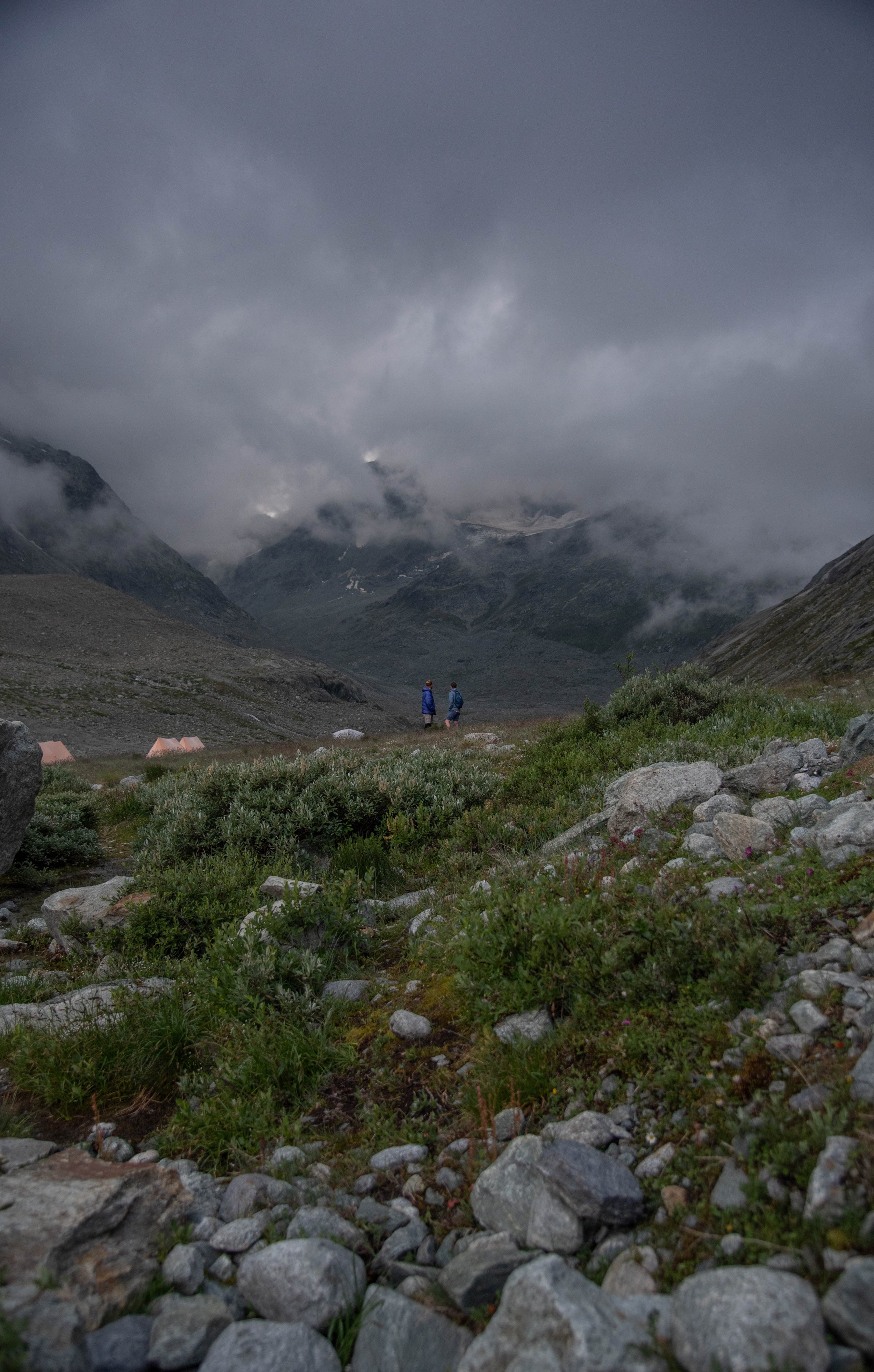
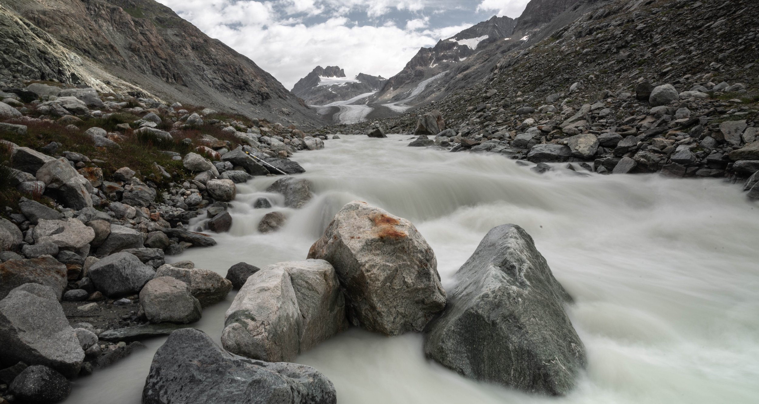
melting water torrent
Weather stations and glacier ascent
The second day begins and except for Alexander, Mike and Thomas who take with them the disassembled weather stations in their bags to bring them to the lower part of the glacier, we stay at the camp to rest a little and get acquainted with the place. The glacier is in a direct line in front of us, so that after a few minutes I can distinguish three tiny silhouettes in this palette of grey, in this landscape of simply enormous dimensions (photo on the right)
Glacier d’Ottema seen from the braided rivers forming at its foot
Glaciers can be covered with debris to varying degrees. While this one is relatively "clean", some glaciers are almost completely buried under tens of centimeters of rocks and rubble. If they don't fit the traditional image of a white, pure, smooth glaciers, the rocks and debris create a formidable thermal insulation which can considerably slow down or even stop their melting. On the other hand, a too low thickness of debris is more likely to accelerate the melting since the rocks, by their thermal properties, absorb the infrared radiation, the heat, which is then transmitted to the ice, almost directly underneath
In the camp, we have our orange tents to sleep in and a little further on a main tent to cook, it is there that we meet to discuss mountain related things like alpinism that some of us practice, the studies carried out on the glaciers, the organization of our days and the tasks to be carried out or simply to discuss about everything and nothing. I discover the life in a base camp where resources are precious, from water to gas and cereal bars very useful for the days of walking. It is a welcome preparation for the 3 weeks I will spend a month later in Pakistan in conditions that are undoubtedly harsher and being even further away from inhabited places. When they return in the afternoon, in a hurry after a the rain started pelting down in the valley, we gather at the main tent and make lunch all together, until two new people, two French PhD students in glaciology, join us. Marin and Achille know each other well and the latter tells us that he has just returned from Tajikistan where he says, to make us feel better maybe, his three weeks in the mountains were a succession of very rainy and cold days. When I ask them if they are also participants in the TEMPEST project, they tell me that they come first and foremost for the fun of it. I like this spirit.
Thomas and his first station on that glacier
The goal is to understand in detail the weather conditions at the surface of the glacier. For example, the formation of katabatic winds, caused by the cooling of the air in contact with the glacier surface, can modify the surface temperature of the glacier, particularly downstream, and consequently the melting. These temperature changes are currently difficult to model and require the use of in-situ stations.
The location chosen for the highest weather station on this glacier, at 3100 metres, offers an impressive view with peaks towering above us, drawing the boundaries of the great white plateau on which we humbly stand, seeking in a scientific endeavour to understand nature and measure what can be measured, to make measurable what can be measured. Where we stand, the glacier is probably several hundred metres thick. Here, the melting seems less pronounced, in contrast to the lower elevations where we see surface streams that eventually sink through the ice cover and join the under-glacier stream, a river flowing beneath the glacier.
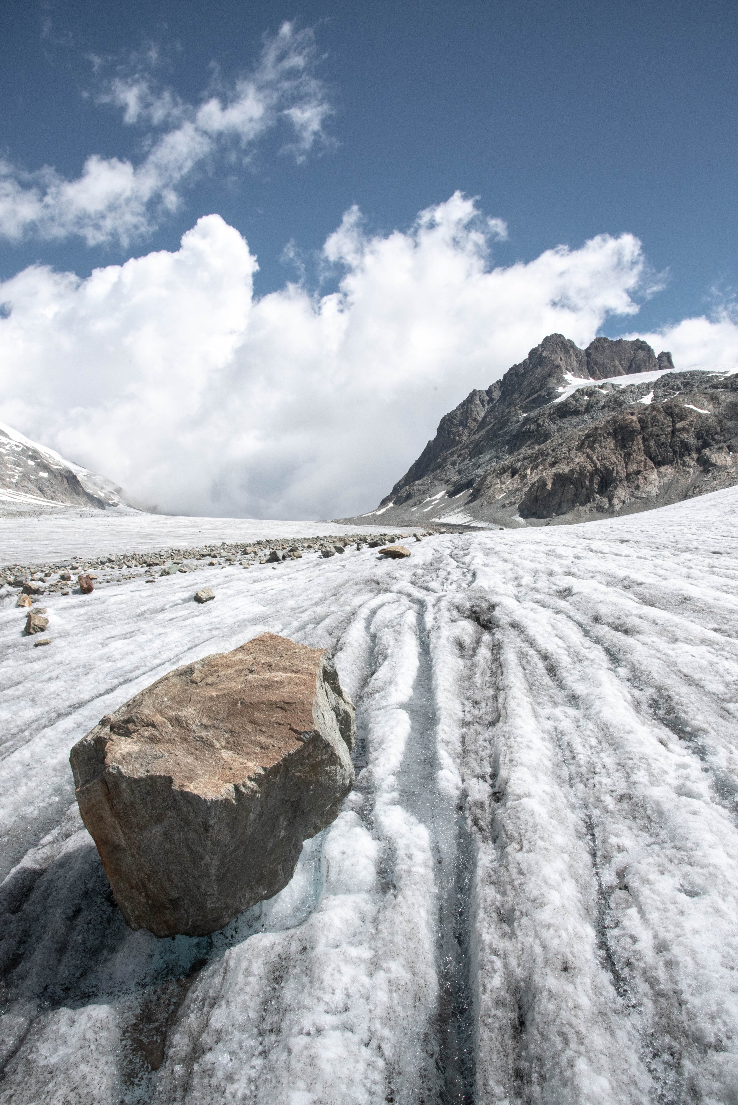
On the third day, we join Alexander and Thomas at the first weather station, at the beginning of the glacier, and then continue our journey without them, as they will stay there to fly the drone. Our job will be to carry in our backpacks the parts of the weather stations that we will assemble at various points while progressively climbing to the top of the glacier. The slope is gentle, the surface smooth and the landscape changes little but I still observe some typical glacier characteristics : crevasses, moraines, moulins, small torrents of surface and finally the most peculiar, big rocks raised of sometimes almost a meter, held on a column of ice which was spared from the melting by the insulating effect of the rock of which it ends up becoming the pedestal. Little by little we unload the metal sticks and sensors to assemble them at each point, until the top where a more elaborate station will be held, like the first one, for more comprehensive meteorological readings.
Hoisting a mast, like in Iwo Jima, for Science’s sake

Marin advancing firmly on the glacier carrying a weather station
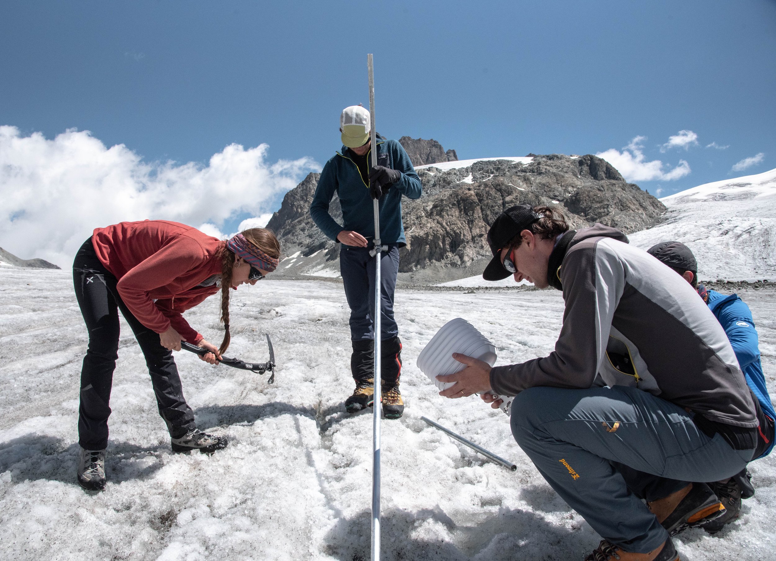
Marta uses a ice pike to create a suitable place for the station to stand
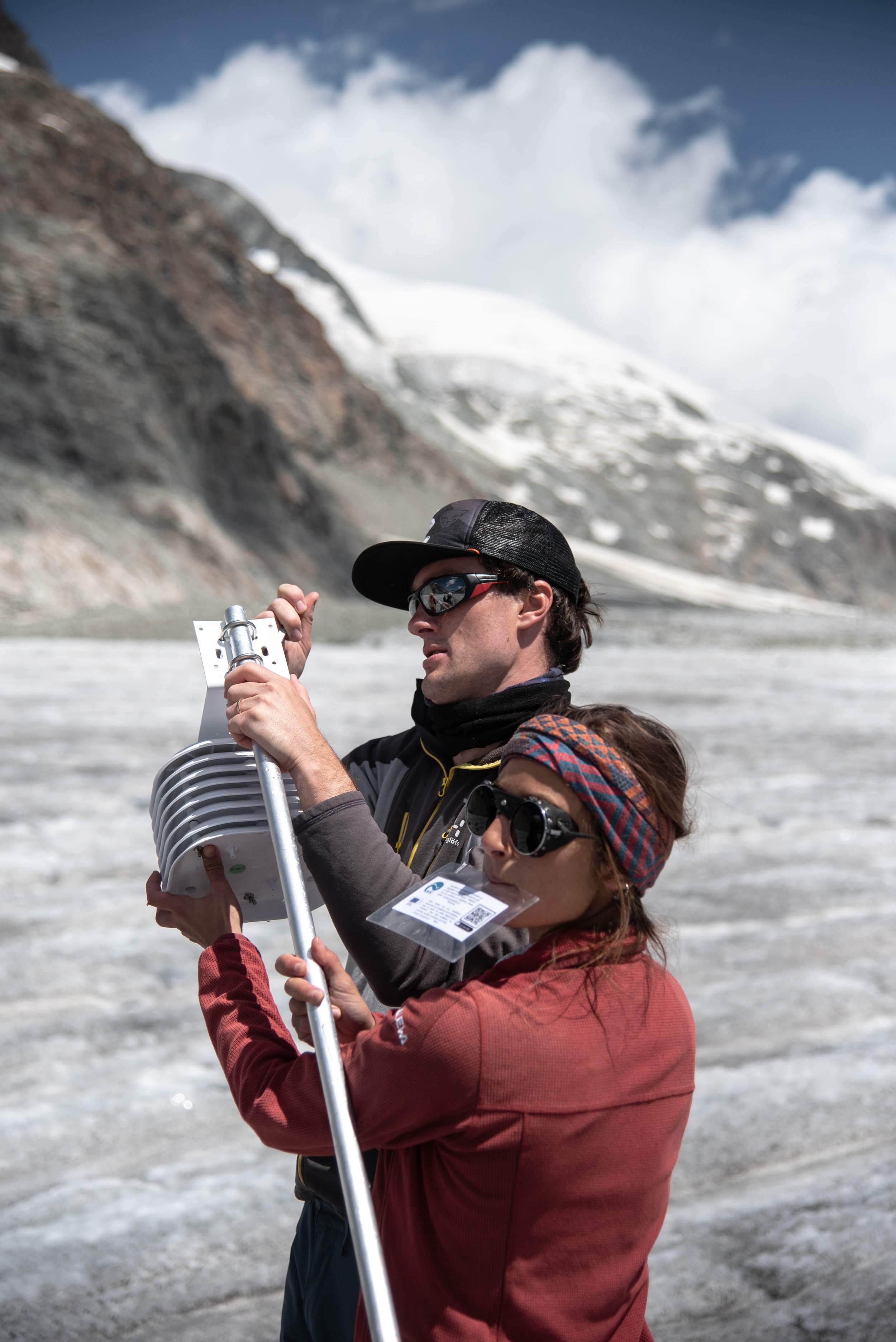


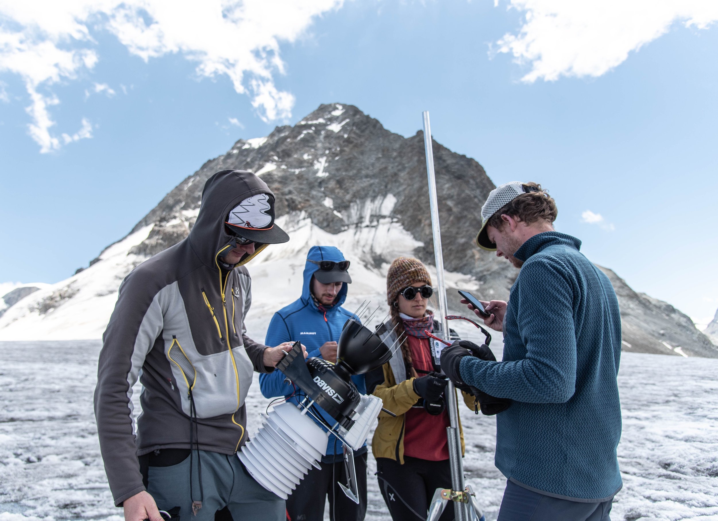
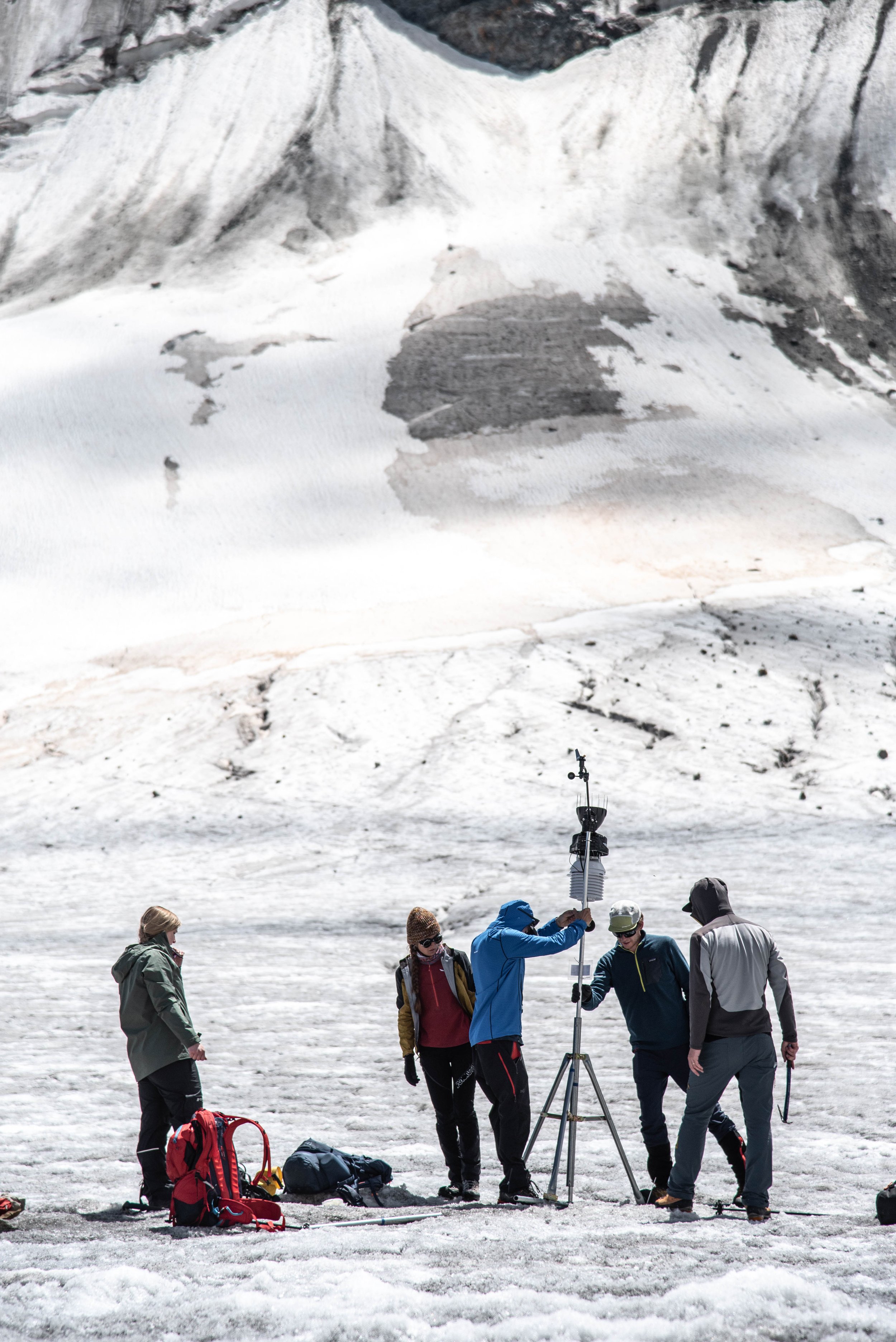

Enjoying good work finished
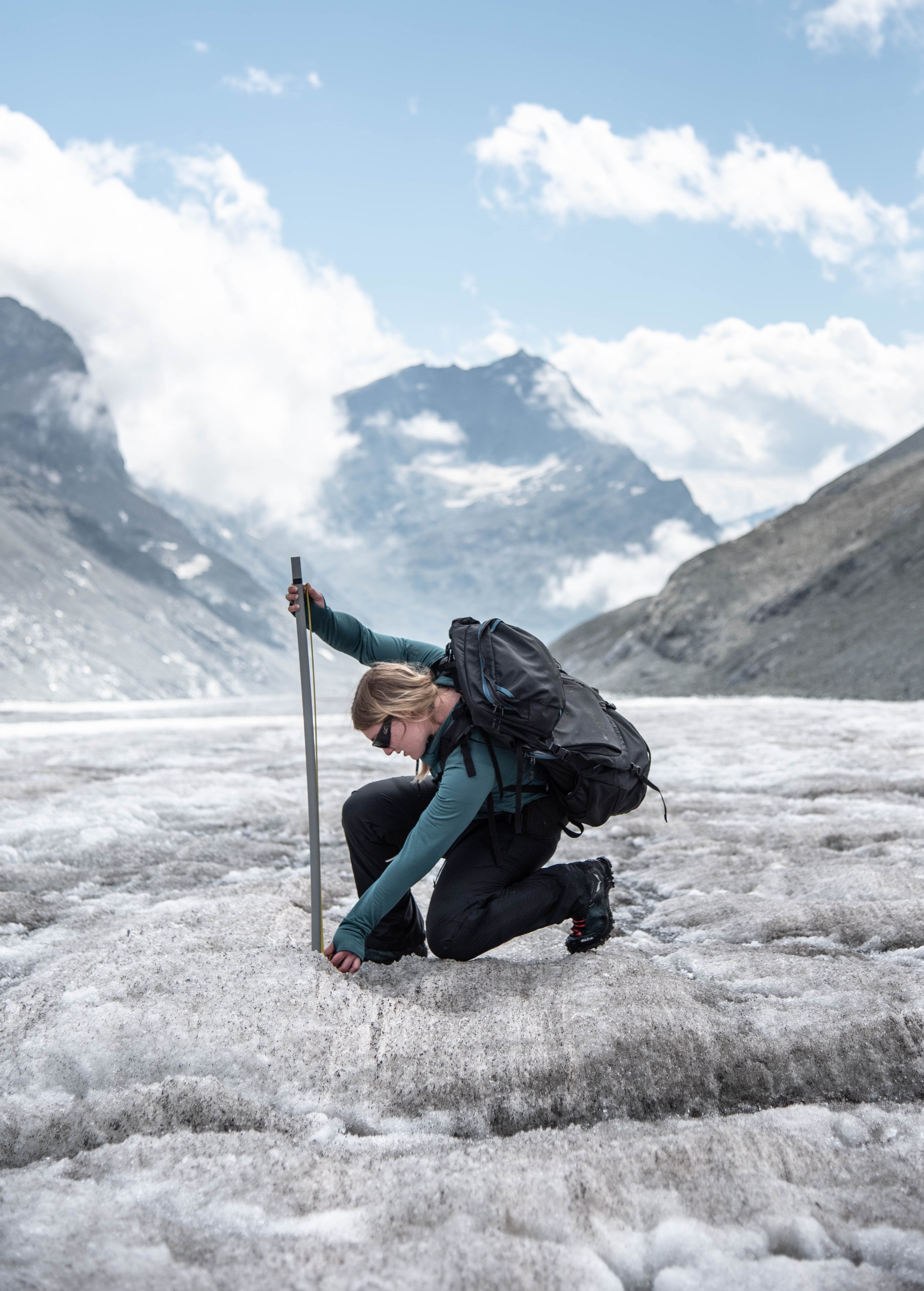
Ann Christin noting the difference in height at the surface of the glacier, as evidenced by the ablation stake now out in the open
I go back down accompanied by Ann Christin while the others go ahead of us to put a station halfway up the rocky side of the valley, allowing to have comparative readings with respect to the ice. So we start to go the other way around, equipped with a GPS and a meter to measure the ablation stakes, which are planted at a given moment and measured later when the ice in which they were buried has melted. One meter, two meters, sometimes four meters of melt in height as we progress down the glacier. Most of the lost ice will probably not be regained next winter unfortunately. We end up meeting Thomas and Alexander on the way down, who tell us about a " challenging " day for the drone flights, because of the cold winds all day and the equipment malfunction. After this exchange, back at the camp, we enjoy each during the meal a can of beer as a reward after this hard day. The weather is not good, but it is a bright and precious moment.
High-flying
On the third day, Alexander, Ann Christin, Marta and myself are flying the drone once an hour from 10 am to 6 pm over the lower part of the glacier. We leave the camp in the morning with a nice weather ahead of us and get straight to work, where the basic idea is to drive a screw in the ice to which we attach a rubber band, which once stretched is connected to the drone. All that is left to do is to hold the drone and release it so that the other person activates the throttle via the remote control at the same time to allow the machine to take off safely. Once in the air, Alexander keeps an eye on the aircraft which spins in the sky while rising to more than three thousand meters and then descends, also in spiral above the zones of "debris" the zones of the glacier covered with gravel and rocks fallen from the sides of the valley. Another person fills in a note card and observes in real time the data collected, on the computer screen. This data will allow to establish a profile of the atmosphere above the bare ice and above the rocks according to the time of the day, knowing that the winds sometimes change direction after several hours, or simply stop blowing, and that pretty much all the other variable are likely to change as well.
Thomas and Alexander, tested by the day's unfavorable conditions
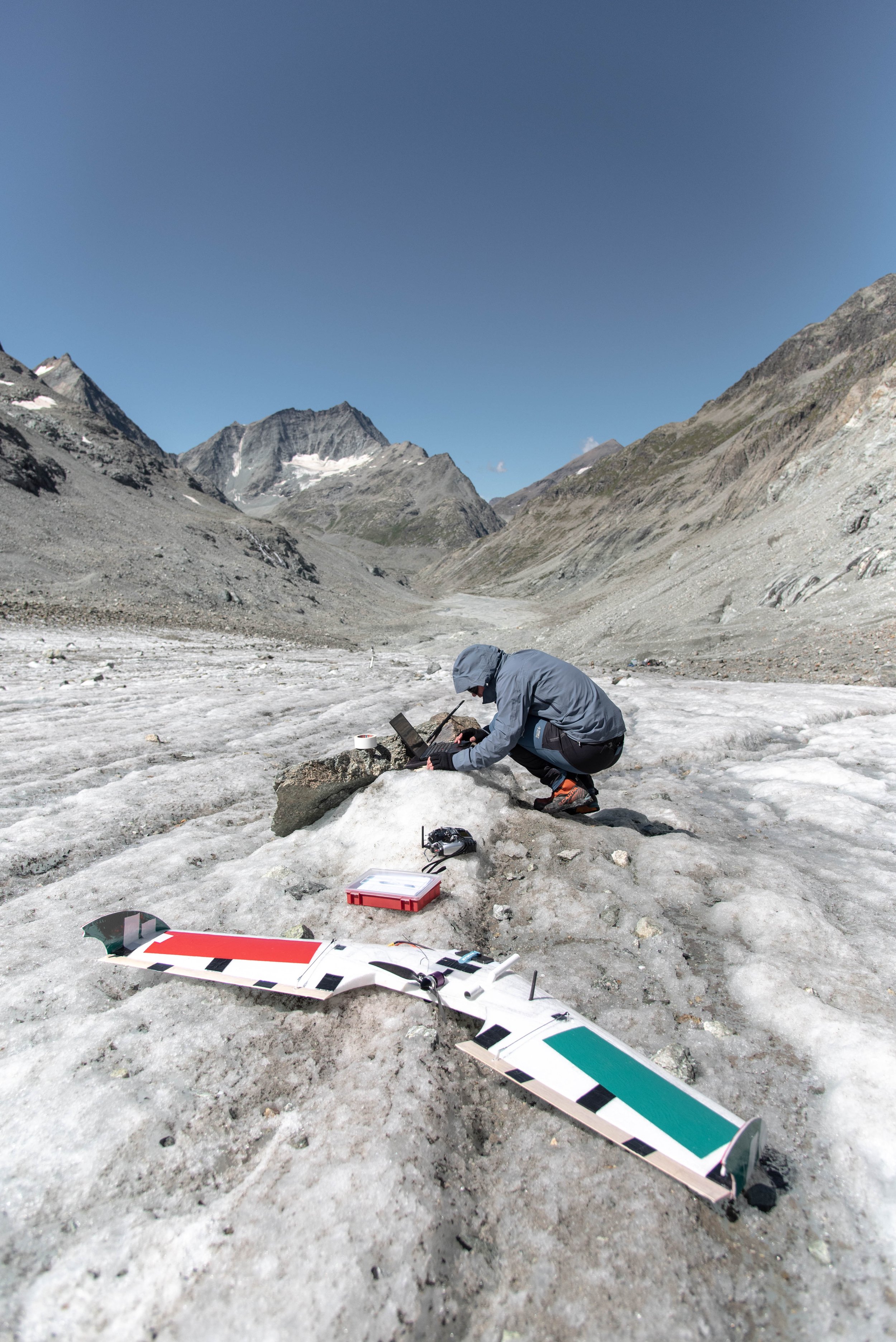
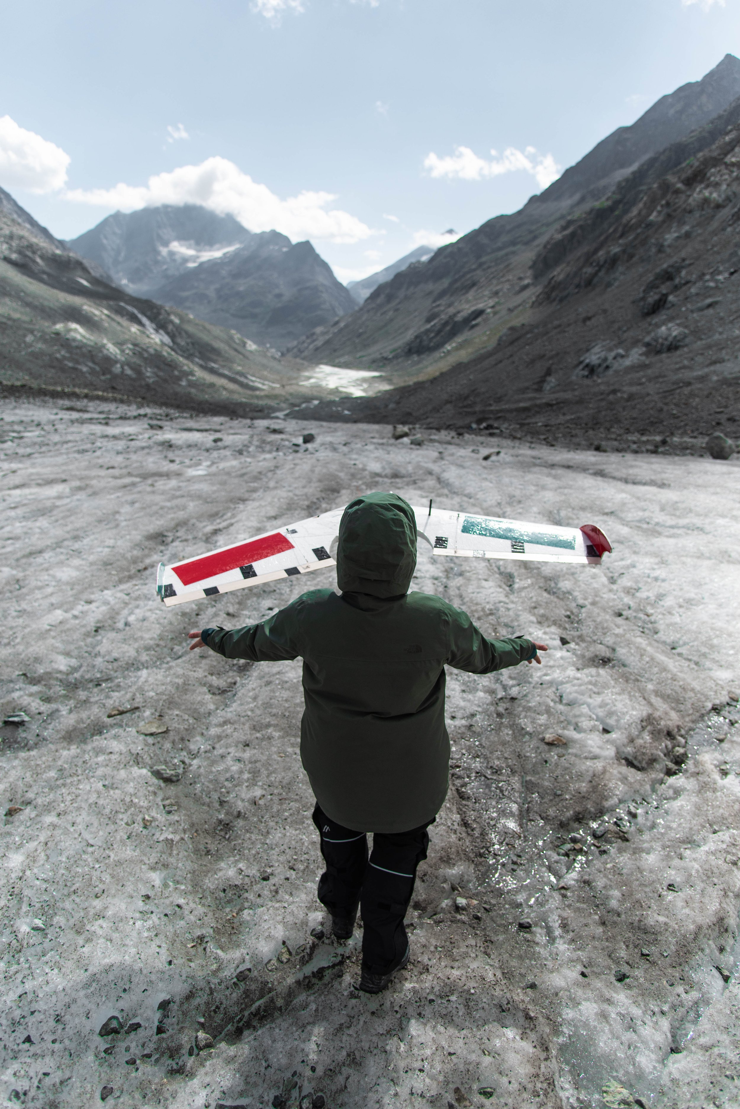
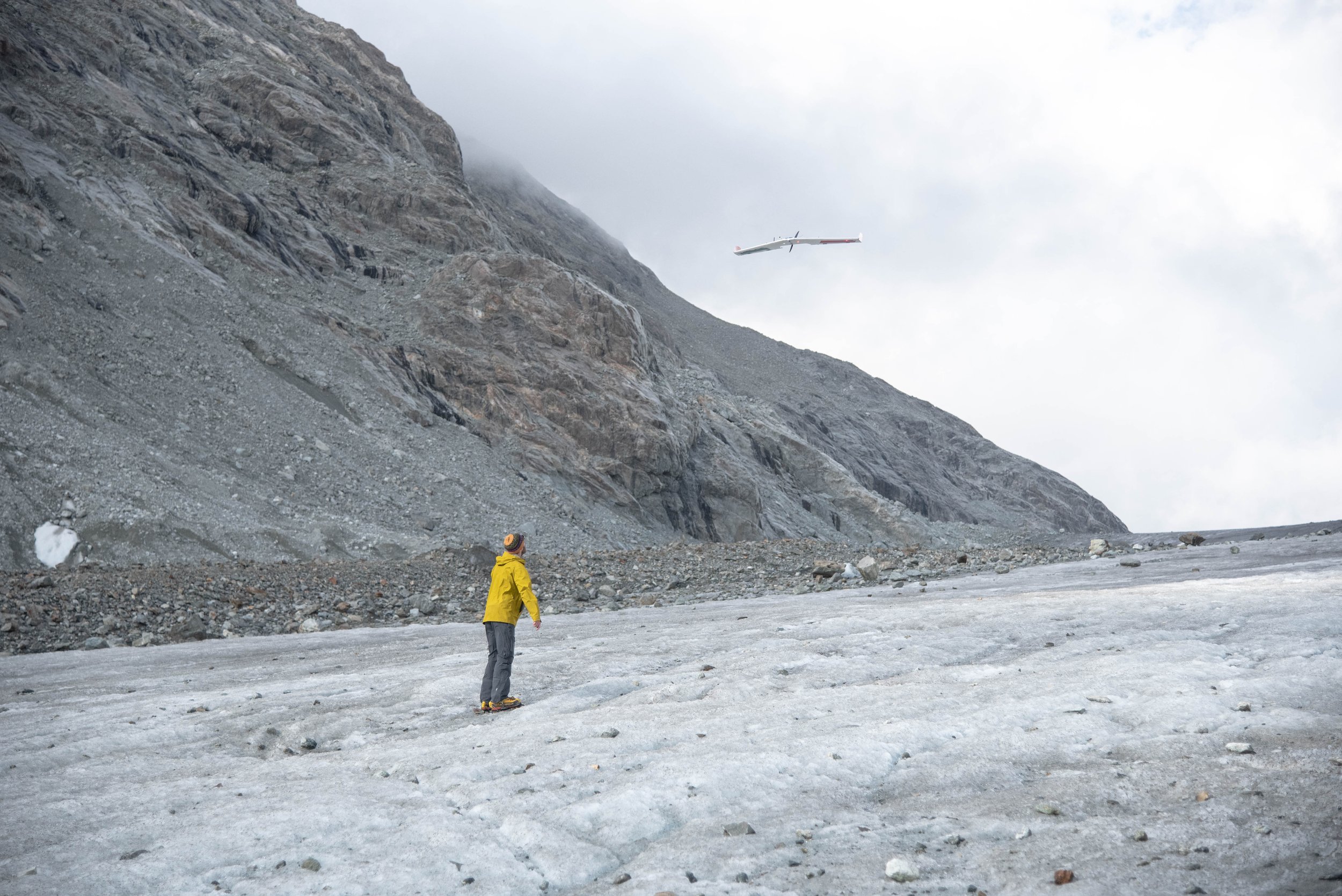

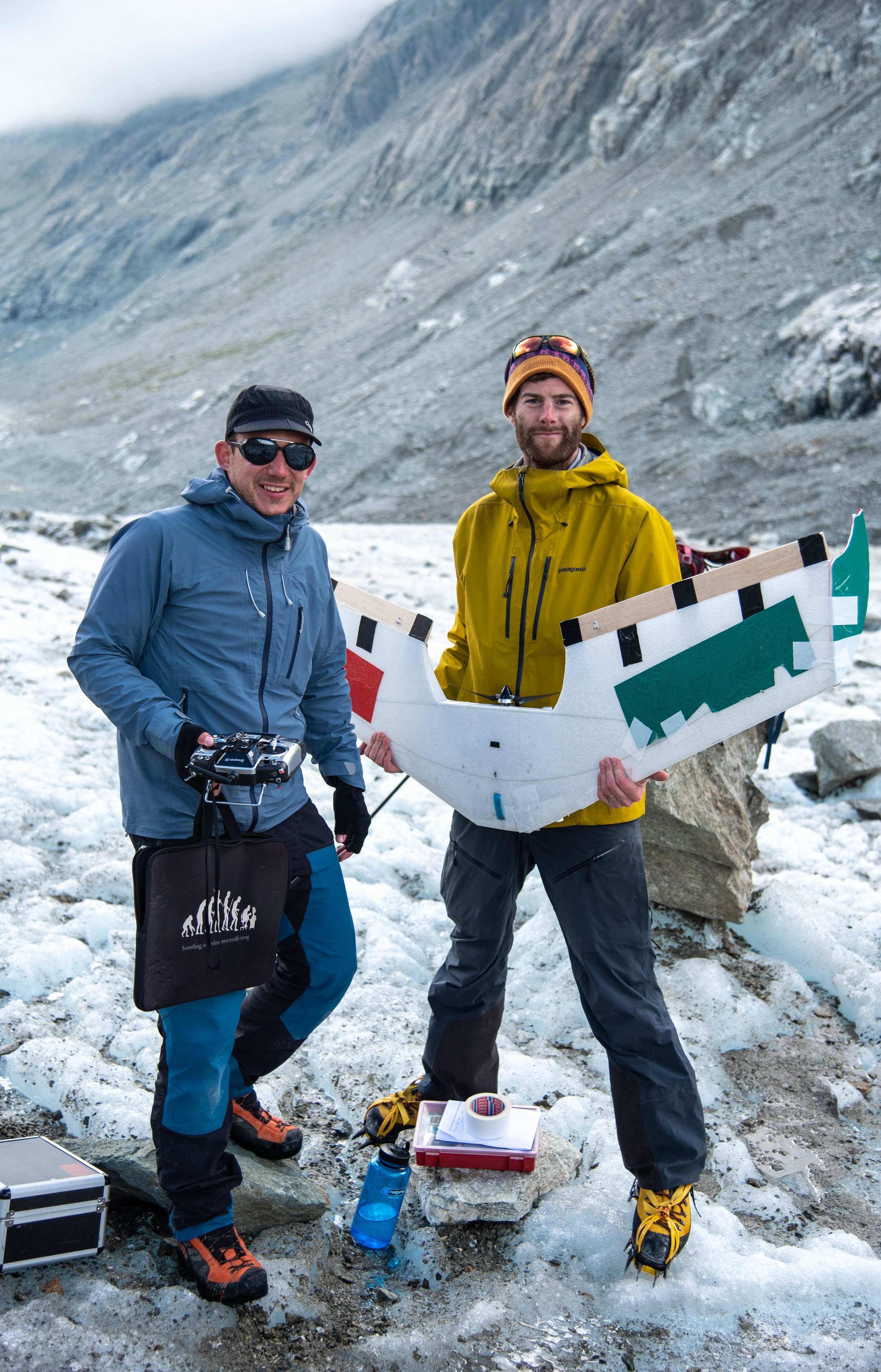

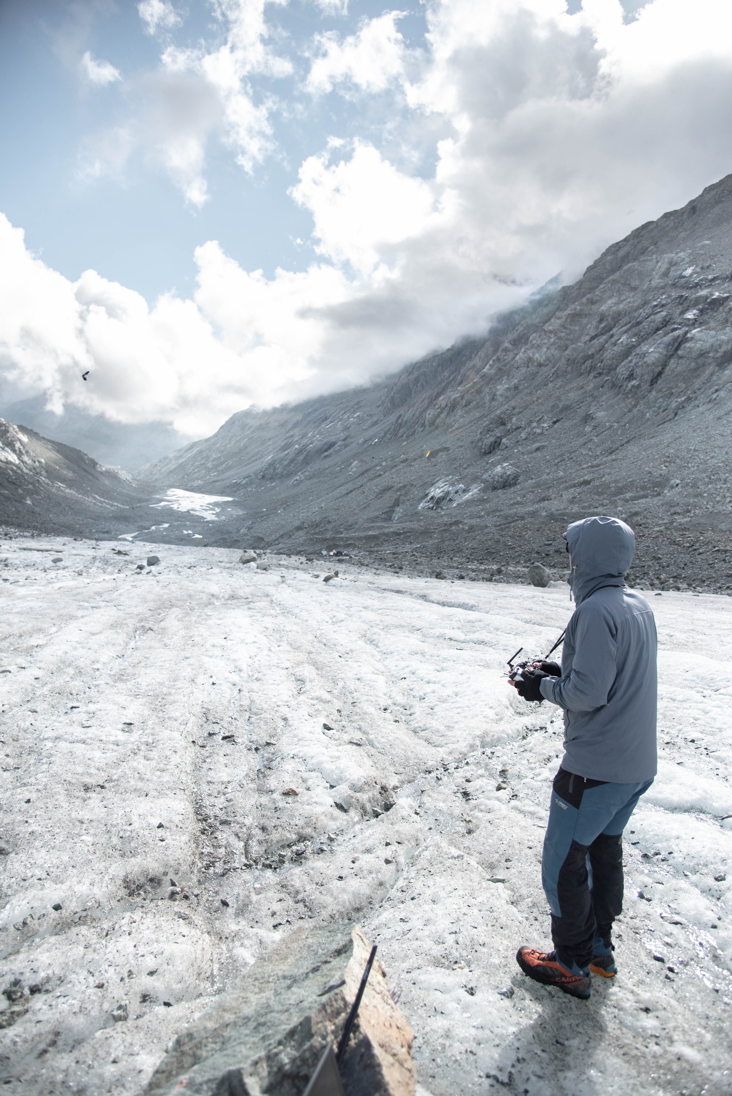
After a day of enjoying between two drone flights the meditative shapes of the ice, the mountains and the rocks balanced on their frozen pedestal, we head back to the camp and I take a few last pictures to capture the beauty of the pastel tones of the ice and the beauty of the flora growing among the richly textured rocks. The evening takes on the look of a banquet where we finish all the food. Then comes the unavoidable moment when we say goodbye: we leave at different times and will not see each other the next day. I am grateful to have been there, to have been able to meet these people who taught me a lot of things about glaciers, these people who shared with me their scientific, almost gnostic but also emotional link with the mountain and this winter world, rough and so pure. After a restless night, I wake up at dawn to leave my tent behind and start to go back down to the human world where a long succession of buses, trains, car sharing rides and some driving bring me home. When I arrive I have the solace of having someone to tell about my four days, a chance to relive the experience.
I want thank every one in the team I shared these memorable days with and especially Alexander Groos who made this possible for me, besides his support and kindness.


